There are four main techniques used in space geodesy :
- Very Long Baseline Interferometry (VLBI)
- Satellite Laser Ranging (SLR) and Lunar Laser Ranging (LLR)
- Global Navigation Satellite System (GNSS), including the U.S. Global Positioning System (GPS), the Russian GLObal NAvigation Satellite System (GLONASS), and future systems such as Galileo, Beidou/Compass, and QZSS
- Doppler Orbitography and Radiopositioning Integrated by Satellite (DORIS)
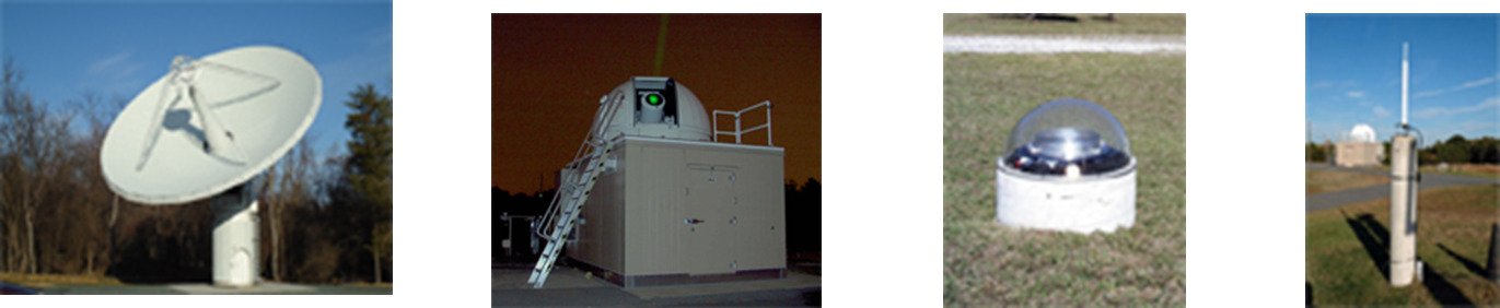
(VLBI, SLR, GNSS and DORIS respectively in the image)
The VLBI technique has been employed in geodesy for more than 40 years; it measures the time difference between the arrival at two Earth-based antennas of a radio wavefront emitted by a distant quasar. Using large numbers of time difference measurements from many quasars observed with a global network of antennas, VLBI determines the inertial reference frame defined by the quasars and simultaneously, the precise positions of the antennas. Because the time difference measurements are precise to a few picoseconds, VLBI determines the relative positions of the antennas to a few millimeters and the quasar positions to fractions of a milliarcsecond. Since the antennas are fixed to the Earth, their locations track the instantaneous orientation of the Earth in the inertial reference frame. Relative changes in the antenna locations from a series of measurements indicate tectonic plate motion, regional deformation, and local uplift or subsidence.